Cape to Cape, Done and Dusted!
Take a Walk in My Shoes as I Stumble, Fart and Waddle from Cape Hedo to Cape Kayan. Never again!
"Never again" came the statement as I lay slumped in a bubbling mess of blisters, macerated soles and limbs screaming with cramps. Never again would I put myself through that. At 53 I had nothing to prove and definitely nothing to gain except a body that would surely revolt against the brainwaves that drove it forward? And so here I was, two years later, with those words ringing in my ears about to step out into almost typhoon conditions at the Northernmost tip of Okinawa, Cape Hedo. This is a region renowned for it's violent and destructive winds. With gusts almost hitting 50mph it was a tad bonkers to be setting off in such conditions but I was mentally prepared. A final thought about what I was letting myself in for and I was off. Parting ways with a fist bump to a good buddy, *Max, who'd graciously driven me all the way North to my start point. I stepped out of the noticeably rocking car, threw on my double packs, put my head down and headed into the fading light of the late afternoon.
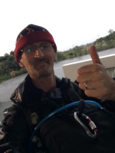
Just after setting off.
It wasn't long before the first decision had to be made. My plan was to take the North Eastern coastal road heading South. Within a few hundred meters of setting out I switched that to the North Western route via #58. The winds were getting brutal, gusts to 50mph, at times it sounded like the forest around me was going to snap. The sounds of 'Ma Nature' complaining about the onslaught of winds was pretty intense. Not to mention by now it had also started pouring with rain so that rain being driven at me on a head wind at those speeds would have been torturous.
As is normal with such walks I like to get into it and then after a kilometer or so use that time to see if all the gear starts to 'sit' properly. No buckles digging into me, footwear issues or the like. To this end I opted to head uphill from Cape Hedo to the Kayauchi Banta observation area. They had cover there and spacious restrooms that are open 24/7 and would allow me space to 'spread' if I needed to unpack and repack gear to get comfy etc. On a clear and sunny day this is one of my favorite views out across the North Western coastal area. Alas on this day it was a fogged out, blustering maelstrom of rains and a whipped up twister like foliage.
With all the gear good, checked and rechecked. I had to pad out one particular buckle on my front fitting pack as it was just a little niggly on my left shoulder blade. With that done I was good to go. My plan from here on in was to head South on Route #58 and then cut back to the originally planned Eastern coastline via Route #2 which is the northernmost road that cuts directly through the Yambaru National Park to the eastern coast. At least that was the plan. And plans, as they say are often doomed to fail...
At this point just a couple of things. In the past I had walked from South to North, from Cape Arasaki to Cape Hedo. This was done however in warmer months so I had the great option to sleep on beaches during down times to recharge the legs and soothe the body. With that plan of attack in mind it didn't bother me too much that I was going from the developed and crowded southern confines of the island into the northern, peaceful and lightly inhabited regions of the Yambaru, that green Ocean of nature and trees. With few services and limited public transport it requires complete faith in your abilities to be in these parts when your body is screaming out for rest and respite. When your brain is screaming every conceivable excuse for giving up. It's at times like these when you have to just give that little voice of reason in the back of your mind a little cuff around the ear and keep on walking.
I don't know why but that little voice, whenever it makes itself heard has always, in m case, got a strong Scottish accent?? Go figure.
So it made sense, to me at least, in such conditions to start off with the isolation while my legs and self were in good condition and I would then be walking toward civilization, services, amenities and aid, should I need it, as I progressed through the walk.
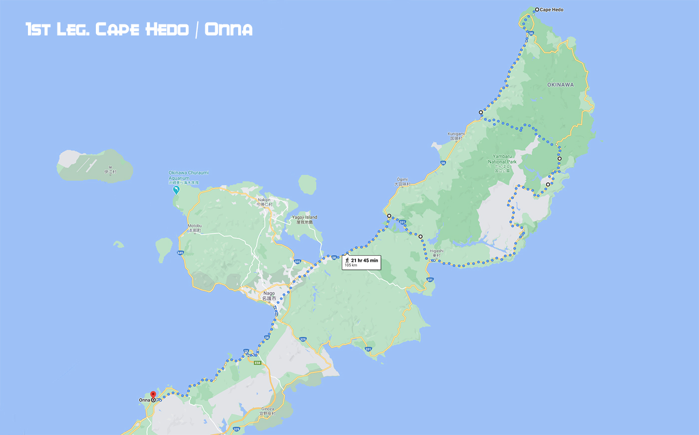
Once I'd cleared the main area of Cape Hedo and away from the first settlement I passed, the fishing town of Ginama, the winds became tail winds which were a godsend as they no doubt helped my progress. Unfortunately the one thing I had forgotten to pack or administer was Vaseline! Normally on such walks I'd put a good amount of Vaseline around my 'family jewels' and rear end to stop any friction burns / nappy rash etc. These would occur not simply from the effect of bodily 'elements' rubbing together, butt cheeks and 'happy sack' etc but also from the constant rubbing of clothing or underwear. Something that was compounded when said clothing items were saturated either from rain, or sweat. This omission would come back to haunt me later.
Another thing I had to bear in mind were the main factor that will make or break this trek, my feet and their wellbeing. One issue with feet is that they're constantly wet normally from sweat but in this instance due to immersion in puddles. In the current case due to the weather at night with my head down and no headlamp (walking with ambient light) I couldn't see how deep the puddles and areas of collected water were that I was stepping in. Sometimes just surface water, other times a few inches deep. It wan't long before my feet and footwear were absolutely drenched. I had been treating my footwear with polish daily before the off but hadn't been lucky enough to find any, what we call dubbing in the UK, or waterproofing sealant. In the end I was fine with that. I knew there was going to be some hardships in the walk and I was prepped for that.
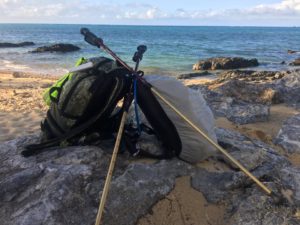
30lbs of safety and essentials.
Maceration is a thing to watch and feel for. It's like when you submerge your hands in water for too long and they get the Prune Fingers look. Well that was happening to my feet. In the first three hours of walking I'd already changed my socks three times. And then came Route #2! Leaving route #58 I headed across the island to reach my intended route along the the eastern coastline. I'd made that decision purely based on it being different and more natural as it went into the Yambaru as opposed to skirting it as does Route #58 on the West. Now I wasn't carrying a tremendous load in the grand scheme of things, all told around 30lbs of gear split between a backpack and front pack. As I walked into Route #2 it was a steep incline winding into the green heart of the Yambaru. With the torrential rain the surface layer of the road was simply running water. I'd end up changing my socks again when I got to the Eastern side.
And so it continued. When elements of the road now traveled meandered further towards a Northerly heading there would be times when I'd get blasted with head winds and driving rain and that had a nasty habit of getting into my rain jacket and then streaming cold rivulets down my body warmed inner clothing and self. When I got to the Eastern coastline I then realized what a mistake that call was. The winds were brutal. Even acting on the surface area of my small backpack they were enough to push me off balance, interfering with my cadence and thus interrupting my breathing pattern. For me long walks like this are all about about setting a rhythm with strides and breath. From there it's just a matter, for me, to put my head down, focus on that small area of about 3sq/ft in front of me and concentrate on the act of taking one step after the other.
Shoulders wise I noted a pattern. After each rest which were taken whenever I felt I needed one, around every two and a half hours at the beginning of the walk down to every hour or even 40minutes toward the end. Each rest would be dictated by the complaints of my shoulders. It's normal even with lighter weights that said weight will act on the shoulders. I'd find after a rest I'd be fine to walk with sticks on the uphill segments and swinging arms on the flats. This would then shift to supporting the front pack like a toddler and thus relieving the weight of that from my shoulders. Lastly I would clip my sticks to my front pack and then hoist both sets of shoulder straps upward with my hands and walk like that for a while. When that phase became uncomfortable I'd take a rest. Rests would normally last anywhere from 10minutes to the main rest and sleep break that I took once I arrived in Onna. But that was a ways off from my current location.
On seeing the road sign for the Higashi Damn I opted to leave the Eastern coastline and once again head Westward. Glad to be away from the beating winds and rain I once more melted into the green and wild swaying embrace of the Yambaru. Now me being the nature minded guy it didn't leave me to think about wildlife and wildlife encounters. Given that there's a lot of mating going on now in frog populations around the island it's a great time to potentially find some of the Snakes of Okinawa and Other Cool Critters out and about too. In one little marshy clearing right next to the main road I encountered literally hundreds of amorous Green Tree Frogs, croaking for their hearts content, but in the same time being watched by no less than three snakes. Two Hime Habu and one Akamata who already had one unfortunate little amphibian grasped tightly in its expanding jaws. Poor Kermit!
The Kilometers came and went. I rejoined Route #58 just by the bridge at Shioya Bay in Ogimi. Having set out at 1730hrs on Thursday late afternoon it was now almost 0530hrs, and 68km into the jaunt. averaging 5.6km/h which was just a little over my expected 5km/h. I was happy with that but if the truth be known I was starting to feel myself slow a little. Arriving at the outskirts of Nago I'd decided by that time to head through the main city center and head further south to Onna where I would lay up for a few hours to get some sleep, dry out my clothing and let the sun, which had made an appearance at last, recharge my weary legs. I'd toyed with the idea to rest up in Nago but I was of the mind that that would have been to greater a second leg, Nago to completion, on tired and aching pins, ahhh no thanks. So onwards I trudged.
I finally laid down on the sand in Onna at 1230hrs after resting for about an hour in Nago. I found a natural wind tunnel through some shrubbery on a beach and set up a drying line onto which I hung all the wet kit I'd been wearing for the last few hours, drenched this time around by sweat, not rain. It was bliss to let my feet simply get some air and sun. My legs too, starved of light for the past hours drank in that great warmth and rest. I was happy to sit there loading up again on water and energy input. I'd made a batch of what I call 'Go Mud' which is basically a tupperware container with a mixture of Oats, Peanut Butter, Blackcurrant Jam, Ground Almonds, Hemp Seed, Poppy Seed, Water and diced Figs. Now it looks as if I'd filled it from the back end of a cow but man does it put you on cloud nine! Rocket Fuel. The missus had also made me one her awesome gluten free carrot cakes. Good times. I would wash both of those down with a mixture of water and Pocari Sweat, a favored sports drink here in Japan, that was carried in a drinking bag located in my front pack for easy access.
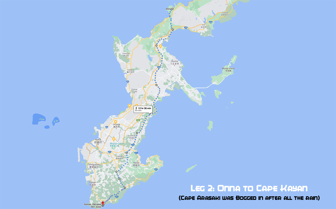
Five hours later it was time to head on. With my shoulders rested, my feet prepped and ready with dry footwear and socks. My belly satiated with Mud and Cake, my liquid levels at full I was once more set to go. Having now stripped off my outer layer of Goretex Pants and Rain Jacket I was starting out, albeit somewhat stiffly on the final segment. Just another 60 odd km and I'd be good. But it was on this leg that I'd suffer more than I had as yet. I guess it was simply a matter of the continuous friction mixed with the lack of decent resting places that forced me to walk greater distances when I should have pulled up to rest.
I'd crossed over to Ishikawa with the plan to stick on Route #329 until Yonabaru. Just five km into that leg after Ishikawa the rains came again. I was slow to react and got somewhat wet before I could get complete cover. With nowhere to dart I simply dropped my gear on the sidewalk and pulled on the wet gear, much to the amusement of some drivers. I don't know if the honks were from folks who knew about the walk offering toots for encouragement of some crazy 'Gaijin' adjusting his clothing in public view on their way home from work? Who knows. I was beyond caring. With sodden undergarments I set out again. And this was a mistake. I should have taken time to find somewhere to change completely, underwear and socks. Needless to say. skin that was already 'fragile' was not under a new attack, and it succumbed.
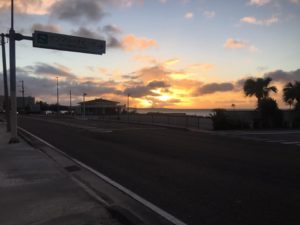
Clear skies would soon be replaced by rains, again!
As each kilometer passed I could feel elements of raw patches appearing. I had that weird sensation of when trying to sit my left butt cheek feeling decidedly 'wet'. "Crap, I hope that's not a blister" but it was the length of the 'greater divide', now that would have to be some blister. I managed sitting by almost being on my complete right side. That mixed with the pain in my feet every time I started up from a rest period had me wondering quite what the state they would be in at the end of this thing. These things were to be expected. Once I realized that I'd forgotten to 'grease up' I knew I would be in for some discomfort.
By the time I arrived at Yonabaru my pace had slowed to a painfully slow 3km/h. I was starting to hurt. When I finally came off the #329 and found a place to rest I checked the last off the mapped route. It was showing 19km, I was seriously contemplating jacking it in at that point. By now it was almost 0600hrs and I was on my chinstrap. But I'd felt this way before. Where there's a will, there's a way. I got some Mud inside me, the cake was by now all gone. I swigged down a half liter of Pocari Sweat / Water mix and lifted myself for the off. I'm sure I must have been a sight. Setting off after each rest I must have looked more like a constipated duck waddling and grimacing as I went, a few grunts here and there too. An oil painting it wasn't. But hardship is there to be overcome. All I needed was to remember the words of my son before setting off. "Have a great walk Dad, you're awesome." How could I fail that?
Those final kilometers just became a mess of rains, rainbows, sunshine and grimaces. With one more decision to make I shifted the end point from Cape Arasaki to Cape Kayan, a difference of a couple of Kilometers. This was purely for the reason that Cape Arasaki is only accessible by some pretty muddy farmlands and given the rains of late those access lanes would have been shin deep in mud, and not the edible kind. Hobbling up the final stretch of roads releases that great sense of achievement. I saw my buddy Max there to collect me, no fanfare, no ceremony, just the way I like it.
All this had been done to raise awareness and funds for Testicular Cancer. I'd walked to raise cash for the OddBalls Foundation and was stoked to have finally reached a tally of £672 or the equivalent of US$975 by todays exchange rate. I mean what's life if you can't do something for others right? There's always someone worse off than you so it's nice to give a little back from time to time.
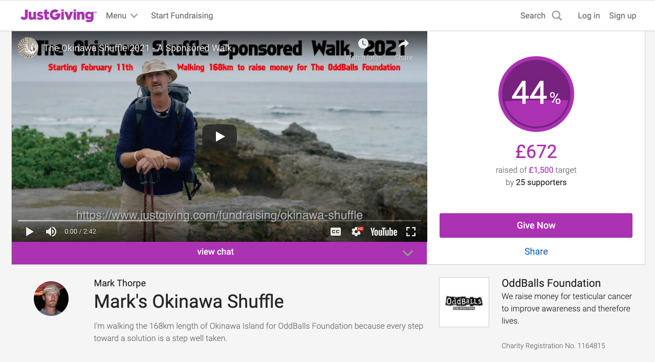
And so with my bum in tatters, the soles of my feet swollen and screaming, with a belly full of Mud and blisters upon blisters on each toe this amazing journey had come to an end. I'd walked a total of 165.4km From drop off to pick up some 44hrs had elapsed, of those roughly 8 were taken in rest so 36hrs of walking to complete. This averaged a speed of 4.5km/h. It is something that having completed twice now, once South to North and now this North to South leg, that I can categorically say I won't be attempting again. That said I have created a private Facebook Group for those foolish enough to carry out this same, or their own route, trek between the capes of Okinawa. I'm hoping it will become a resource for "the few, the foolish and the brave"....
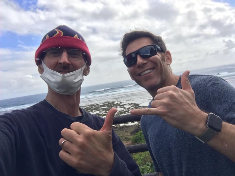
Cheers Max for the drop off and collection, appreciate it fella.
*Max Bloom runs a Veteran based Podcast on his YouTube Channel. If you're into Veterans based affairs and general discussion points please check that out. Cheers.
"I took a walk in the woods and came out taller than trees."
Henry David Thoreau
About the Author
Internationally recognized as a provider of quality mixed media Mark Thorpe is always on the search for captivating content.

Photographer / Cameraman
Mark Thorpe
Emmy Award Winning wildlife cameraman and Internationally published landscape photographer Mark Thorpe has been an adventurer since he could walk! After spending 12yrs in the Military serving in the British Infantry and the French Foreign Legion he went on to hone a career as an underwater cameraman. Seventeen years spent traveling and diving some of the most pristine locations on Earth for a wealth of International broadcast and production clients culminated in his being contracted to work with National Geographic. In that role as a field producer and cameraman he's been privy to a mixed bag of hair raising adventures. For some reason he was always selected for projects relating to large toothed marine predators such as Great White and Tiger Sharks, Sperm Whales and Fur Seals. Additionally he has also been active within Southern Africa on terrestrial projects dealing with a wide array of iconic wildlife.
Currently based in Okinawa, Japan he's always on the lookout for his next big adventure. He shares his exploits online with a totally organic social audience in excess of 200,000. Sponsored by a number of photographic industry manufacturers he is constantly scouring the islands for captivating landscape and oceanscape compositions. Videography wise he continues to create short photographic tutorial videos as well as creating content about the diversity of wildlife within Okinawa and the Ryukyu Islands of Southern Japan.
Mark has just created a Patreon channel where he's hoping to raise an audience of supporters who through small monthly shows of appreciation will allow him to concentrate on the creation of a wildlife and landscape imaging themed YouTube Channel. If you feel that is something you'd like to support you can visit his Patreon Channel for more information.
